Carte Illustrée
1859-1860
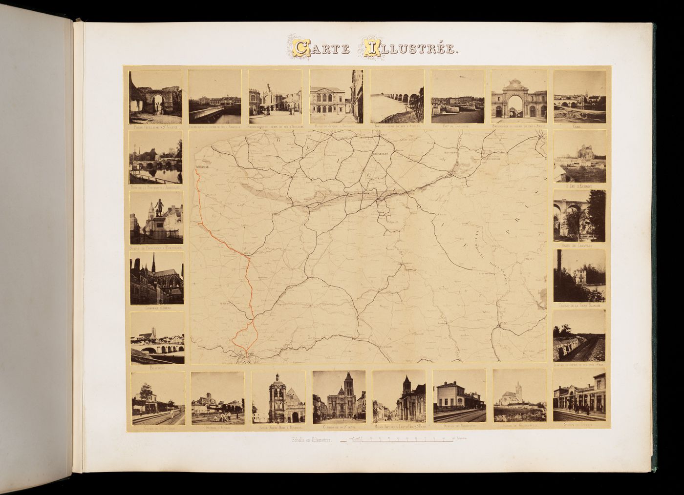
- This plate is a photograph of a railroad map (route depicted in the album is painted orange on the map, mount bears a decorative title with gold initials (top center), surrounded by 24 small views, half stereos identified with the following imprinted titles (clockwise from the upper left):
1. Porte Guillaume à St Valéry
2. Embarcadère du Chemin de Fer à Abbeville
3. Embarcadère du Chemin de Fer à Boulogne
4. Palais de Justice à Boulogne
5. Pont du Chemin de Fer à Étaples
6. Port de Boulogne
7. Embarcadère du Chemin de Fer à Amiens
8. Creil
9. St Leu d'Esserent
10. Viaduc de Chantilly
11. Château de la Reine Blanche
12. Tranchée du Chemin de Fer près d'Orry
13. Station de Louvres
14. Église de Goussainville
15. Station de Pierrefitte
16. Maison Imp.le [Impériale] de la Leg.on [Légion] d'Hon.ur [d'Honneur] à St Denis
17. Cathédrale de St-Denis
18. Église Notre-Dame à Pontoise
19. Station d'Auvers
20. Station de l'Ile Adam
21. Beaumont
22. Cathédrale d'Amiens
23. Statue de Parmentier à Montdidier
24. Pont de la Portelette à Abbeville
Albumen silver print
comp.: 32 x 42,2 cm sheet: 39 x 50,7 cm
PH1981:1025:001
- 24 small photographs framed around a map of northern France, part of Holland and Prussia, with a red line relating Boulogne to Paris
inscribed and numbered
France
Sign up to get news from us
Thank you for signing up. You'll begin to receive emails from us shortly.
We’re not able to update your preferences at the moment. Please try again later.
You’ve already subscribed with this email address. If you’d like to subscribe with another, please try again.
This email was permanently deleted from our database. If you’d like to resubscribe with this email, please contact us
Please complete the form below to buy:
[Title of the book, authors]
ISBN: [ISBN of the book]
Price [Price of book]
Thank you for placing an order. We will contact you shortly.
We’re not able to process your request at the moment. Please try again later.
Your folder is empty.