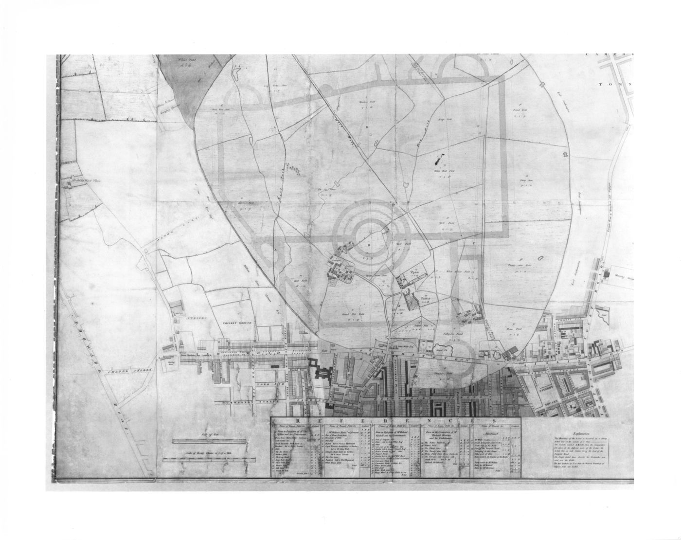
A preliminary design for Regent's Park drawn over a map of the existing site
1811-1812 over a print of ca. 1805
- An engraved map of Marylebone Park and the streets bordering it to the south, with the outline of the street system for an early version of Nash's plan for Regent's Park superimposed in pen and coloured wash.
Pen and black ink with watercolour washes over graphite and engraving
sheet: 134.4 x 113.1 cm
DR1984:0569
Comprised of six sheets joined together and backed with linen. The map image at the top is completely hand drawn; otherwise, hand additions to the engraving indicate proposed transformations or alterations.
imprinted - labels throughout and with a table of property owners keyed to the map, l.c. inscribed - by the draughtsman, in pen and black ink: labels on the hand additions to the engraving
Sign up to get news from us
Thank you for signing up. You'll begin to receive emails from us shortly.
We’re not able to update your preferences at the moment. Please try again later.
You’ve already subscribed with this email address. If you’d like to subscribe with another, please try again.
This email was permanently deleted from our database. If you’d like to resubscribe with this email, please contact us
Please complete the form below to buy:
[Title of the book, authors]
ISBN: [ISBN of the book]
Price [Price of book]
Thank you for placing an order. We will contact you shortly.
We’re not able to process your request at the moment. Please try again later.