98 Results
Form:
books
books

Actions:
Price:
$46.95
(available to order)
Summary:
Des pays qui n'existent pas vraiment, la seule ville presque entièrement souterraine au monde, une chambre d'hôtel britannique devenue yougoslave l'espace d'une journée, une îleespagnole la moitié de l'année et française le reste du temps, une ville qui se résume à un gratte-ciel de 14 étages, la seule et unique voie ferrée installée à l'extérieur de son pays... Le monde(...)
Title:
Atlas des curiosités géograhiques
Actions:
Price:
$46.95
(available to order)
Summary:
Des pays qui n'existent pas vraiment, la seule ville presque entièrement souterraine au monde, une chambre d'hôtel britannique devenue yougoslave l'espace d'une journée, une îleespagnole la moitié de l'année et française le reste du temps, une ville qui se résume à un gratte-ciel de 14 étages, la seule et unique voie ferrée installée à l'extérieur de son pays... Le monde regorge de curiosités géographiques qui sont souvent à l'origine de tensions diplomatiques ou militaires. Bien souvent méconnues, elles n'en représentent pas moins autant d'étincelles susceptibles de mettre le feu aux poudres sur la scène internationale.
Form:
books
books
Publication:
October 2022
October 2022
Subject:
Architectural Plans and Cartography
Architectural Plans and Cartography
Form:
books
books

Actions:
Price:
$67.95
(available to order)
Summary:
Parcourant le monde à travers de magnifiques cartes de toutes provenances et de toutes époques, l’écrivaine de voyage Francisca Mattéoli nous offre une aventure géographique étonnante en une vingtaine de récits sur les lieux qui l’inspirent ou l’ont marquée lors de ses voyages.
Title:
Map stories / Histoires de cartes
Actions:
Price:
$67.95
(available to order)
Summary:
Parcourant le monde à travers de magnifiques cartes de toutes provenances et de toutes époques, l’écrivaine de voyage Francisca Mattéoli nous offre une aventure géographique étonnante en une vingtaine de récits sur les lieux qui l’inspirent ou l’ont marquée lors de ses voyages.
Form:
books
books
Publication:
February 2023
February 2023
Subject:
Architectural Plans and Cartography
Architectural Plans and Cartography
Form:
books
books
Title:
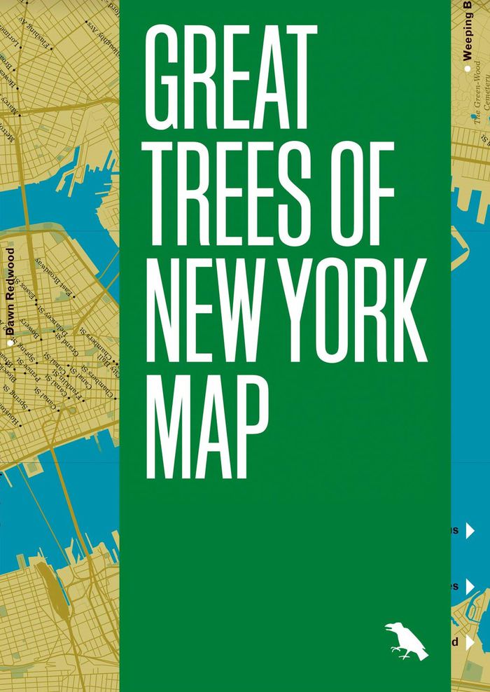
Great trees of New York map
Great trees of New York map
Actions:
Price:
$16.00
(available to order)
Summary:
This is a guide to 50 of the oldest, rarest, strangest, and most historic trees across New York City’s five boroughs, from the 350-year-old “Alley Pond Giant” in Queens to the wizened Camperdown elm in Prospect Park. This two-sided companion includes a map, an introduction and descriptions by Allison C. Meier, and original photography by Colin Montgomery.
Subject:
Architectural Plans and Cartography
Architectural Plans and Cartography
Publication:
May 2021
May 2021
Title:
Great trees of New York map
Actions:
Price:
$16.00
(available to order)
Summary:
This is a guide to 50 of the oldest, rarest, strangest, and most historic trees across New York City’s five boroughs, from the 350-year-old “Alley Pond Giant” in Queens to the wizened Camperdown elm in Prospect Park. This two-sided companion includes a map, an introduction and descriptions by Allison C. Meier, and original photography by Colin Montgomery.
Form:
books
books
Publication:
May 2021
May 2021
Subject:
Architectural Plans and Cartography
Architectural Plans and Cartography
Form:
books
books
Title:
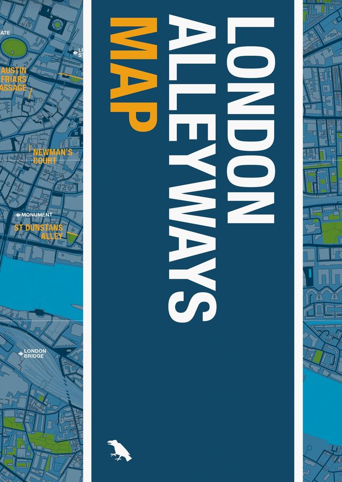
London alleyways map
London alleyways map
Actions:
Price:
$14.00
(available to order)
Summary:
London's alleyways have a habit of leading to unexpected places. They act as the city’s library: echoing the routes of trade, lost rivers, burial roads, disputed boundaries, tracks of animals and people. They hold the stories of a city that otherwise can no longer be seen. This map is your entry point to this story.
Subject:
Architectural Plans and Cartography
Architectural Plans and Cartography
Publication:
October 2022
October 2022
Title:
London alleyways map
Actions:
Price:
$14.00
(available to order)
Summary:
London's alleyways have a habit of leading to unexpected places. They act as the city’s library: echoing the routes of trade, lost rivers, burial roads, disputed boundaries, tracks of animals and people. They hold the stories of a city that otherwise can no longer be seen. This map is your entry point to this story.
Form:
books
books
Publication:
October 2022
October 2022
Subject:
Architectural Plans and Cartography
Architectural Plans and Cartography
Form:
books
books

Title:
Modern London map
Modern London map
Actions:
Price:
$14.00
(available to order)
Summary:
Explore extraordinary examples of Modern architecture built across London between 1930 and 1960 with this two-sided map. Featuring over fifty buildings, from social housing to churches and the Festival Hall, this guide includes original photography by Nigel Green and building details and an introduction by Robin Wilson.
Title:
Modern London map
Actions:
Price:
$14.00
(available to order)
Summary:
Explore extraordinary examples of Modern architecture built across London between 1930 and 1960 with this two-sided map. Featuring over fifty buildings, from social housing to churches and the Festival Hall, this guide includes original photography by Nigel Green and building details and an introduction by Robin Wilson.
Form:
books
books
Publication:
October 2022
October 2022
Subject:
Architectural Plans and Cartography
Architectural Plans and Cartography
Form:
books
books
Title:
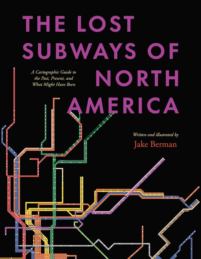
The lost subways of North America: A Cartographic guide to the past, present, what might have been
The lost subways of North America: A Cartographic guide to the past, present, what might have been
Actions:
Price:
$55.00
(available to order)
Summary:
Every driver in North America shares one miserable, soul-sucking universal experience—being stuck in traffic. But things weren’t always like this. Why is it that the mass transit systems of most cities in the United States and Canada are now utterly inadequate? ''The lost subways of North America'' offers a new way to consider this eternal question, with a strikingly(...)
Title:
The lost subways of North America: A Cartographic guide to the past, present, what might have been
Actions:
Price:
$55.00
(available to order)
Summary:
Every driver in North America shares one miserable, soul-sucking universal experience—being stuck in traffic. But things weren’t always like this. Why is it that the mass transit systems of most cities in the United States and Canada are now utterly inadequate? ''The lost subways of North America'' offers a new way to consider this eternal question, with a strikingly visual—and fun—journey through past, present, and unbuilt urban transit. Using meticulous archival research, cartographer and artist Jake Berman has successfully plotted maps of old train networks covering twenty-three North American metropolises, ranging from New York City’s Civil War–era plan for a steam-powered subway under Fifth Avenue to the ultramodern automated Vancouver SkyTrain and the thousand-mile electric railway system of pre–World War II Los Angeles. He takes us through colorful maps of old, often forgotten streetcar lines, lost ideas for never-built transit, and modern rail systems—drawing us into the captivating transit histories of US and Canadian cities. Berman combines vintage styling with modern printing technology to create a sweeping visual history of North American public transit and urban development. With more than one hundred original maps, accompanied by essays on each city’s urban development, this book presents a fascinating look at North American rapid transit systems.
Form:
books
books
Publication:
November 2023
November 2023
Subject:
Architectural Plans and Cartography
Architectural Plans and Cartography
Form:
books
books

Price:
$59.99
(available to order)
Summary:
Featuring 40 essays by U.S. and European historians, designers, cultural critics, geographers and social scientists, illustrated with over 250 color images in extensive visual "gazetteers" — including specially-commissioned portfolios by artists and designers — "Else/where mapping" investigates : how new technologies of navigation and location are emerging to chart(...)
Subject:
Architectural Plans and Cartography
Architectural Plans and Cartography
Publication:
October 2005, Minneapolis
October 2005, Minneapolis
Title:
Else/where : mapping new cartographies of networks and territories
Actions:
Price:
$59.99
(available to order)
Summary:
Featuring 40 essays by U.S. and European historians, designers, cultural critics, geographers and social scientists, illustrated with over 250 color images in extensive visual "gazetteers" — including specially-commissioned portfolios by artists and designers — "Else/where mapping" investigates : how new technologies of navigation and location are emerging to chart "virtual" terrain such as social networks and online conversations; how these new mapping strategies borrow and reinvent metaphors adapted from the cartography of physical terrain, considered at various scales — urban, regional, continental, global ; how new modes of representation of spatial data are evolving to explore the potential for collective "bottom-up" (rather than "top-down") mapping ; how cities, communities and social networks are being re-envisioned, as artists and designers use technologies such as GPS, GIS and digital interface design to devise alternative mappings of social and spatial relationships. Authors : Janet Abrams, Ole Bouman, Andrea Codrington, Denis Cosgrove, Steve Dietz, Paul Elliman, Yuri Engelhardt, Peter Hall, Brian Holmes, J.J. King, Cathy Lang Ho, Andrea Moed, David Pescovitz, Rebecca Ross, Ben Schouten, Alex Terzich, Alice Twemlow, Dirk van Weelden, Tom Vanderbilt, Peter Walsh and Stephen Zacks. Featured artists and designers included : Antenna Design New York, Julian Bleecker, Bureau d'Etudes, Sulki Choi, Layla Curtis, Judith Donath, Entropy8Zuper!, Michael Frumin, Ben Fry, De Geuzen, govcom.org, Marti Guixe, Mark Hansen, Robert Horn, Natalie Jeremijenko, Lisa Jevbratt, Nina Katchadourian, Valdis Krebs, Laura Kurgan, Mark Lombardi, The London Particular, Lumeta.org, Barrett Lyon, Brian McGrath, Julie Mehretu, Paul Mijksenaar, Sigi Moeslinger, MUST Architects, MVRDV, Josh On, W. Bradford Paley, Scott Paterson, Esther Polak, Richard Rogers, Ben Rubin, Warren Sack, Mike Silver, Marco Susani, Terraswarm, UN Studio, Urban Tapestries, Waag Society for Old and New Media, Ronald Wall, Kimberlee Whaley, Jeremy Wood and Marina Zurkow. Book design : Deborah Littlejohn.
Form:
books
books
Publication:
October 2005, Minneapolis
October 2005, Minneapolis
Subject:
Architectural Plans and Cartography
Architectural Plans and Cartography
Form:
books
books
Actions:
Price:
$98.00
(available to order)
Summary:
A multitude of port cities dot Europe’s coastline, each with its own history and relationship to sea transportation and development. In the era of climate change, these cities can offer paradigms and guidance for sustainable development. Taking a comprehensive, map-based approach, "Port city atlas" offers visualizations of 100 port city territories located on four seas(...)
Subject:
Architectural Plans and Cartography
Architectural Plans and Cartography
Publication:
October 2023
October 2023
Title:
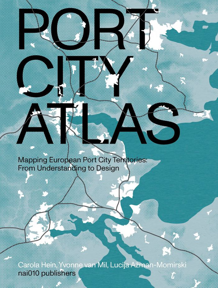
Port city atlas: Mapping European port city territories: From understanding to design
Actions:
Price:
$98.00
(available to order)
Summary:
A multitude of port cities dot Europe’s coastline, each with its own history and relationship to sea transportation and development. In the era of climate change, these cities can offer paradigms and guidance for sustainable development. Taking a comprehensive, map-based approach, "Port city atlas" offers visualizations of 100 port city territories located on four seas and connected through shared waters—from Amsterdam, Antwerp, Barcelona, Bilbao, Bordeaux, Bremen, Calais, Cork, Dover, Dublin, Felixstowe, Fredericia, Ghent, Hamburg, Helsinki, Kiel, Københavns and La Rochelle to Limerick, Liverpool, London, Lübeck, Malmø, Palermo, Ravenna, Riga, Rønne, Rotterdam, Sköldvik, Stockholm, Tallinn, Venice, Zeebrugge and countless others. Conceived as a reference work, "Port city atlas" provides a foundation for comparative analysis beyond the case-study approach, offering a uniquely sea-oriented take on the understanding and urban design of Europe.
Form:
books
books
Publication:
October 2023
October 2023
Subject:
Architectural Plans and Cartography
Architectural Plans and Cartography
Form:
books
books
Price:
$59.95
(available to order)
Summary:
Et si on reprenait l'écrin des cartes d'Antan pour représenter notre monde actuel ? . C'était la carte phare des anciens atlas, mais les ouvrages modernes l'ont délaissée. Pourtant, la mappemonde recèle bien des atouts. Xemartin Laborde ressuscite cette carte mythique dans une approche innovante, où l'esthétisme suranné se marie à la représentation des enjeux(...)
Subject:
Architectural Plans and Cartography
Architectural Plans and Cartography
Publication:
January 2024
January 2024
Title:
Mappemondes : Un voyage dans le temps pour raconter le monde contemporain
Actions:
Price:
$59.95
(available to order)
Summary:
Et si on reprenait l'écrin des cartes d'Antan pour représenter notre monde actuel ? . C'était la carte phare des anciens atlas, mais les ouvrages modernes l'ont délaissée. Pourtant, la mappemonde recèle bien des atouts. Xemartin Laborde ressuscite cette carte mythique dans une approche innovante, où l'esthétisme suranné se marie à la représentation des enjeux contemporains. Introduites par des textes de Delphine Papin et de Francesca Fattori, les mappemondes de cet ouvrage sont autant de formidables outils pour contempler la Terre d'un point de vue global, que des invitations à se plonger dans ses détails les plus étonnants. Des vents et marées jusqu'aux frontières artificielles que les humains érigent, en passant par la répartition des forêts, les séismes, la montée des eaux et le réchauffement climatique, chacune des cartes de cet atlas vous invite à voir notre planète sous un angle différent.
Form:
books
books
Publication:
January 2024
January 2024
Subject:
Architectural Plans and Cartography
Architectural Plans and Cartography
Form:
books
books

Actions:
Price:
$71.95
(available in store)
Summary:
A map is a visual story of the world. It feeds our imagination and shapes our view of the world. A standard atlas, however, predominantly tells only one story: that of the nation-state. It depicts a world in which people are uniformly packed into national containers, enclosed by borders, and in which migration is often represented as threatening invasion arrows. "Free the(...)
Subject:
Architectural Plans and Cartography
Architectural Plans and Cartography
Publication:
March 2024
March 2024
Title:
Free the map: From Atlas to Hermes, a new cartography of borders and migration
Actions:
Price:
$71.95
(available in store)
Summary:
A map is a visual story of the world. It feeds our imagination and shapes our view of the world. A standard atlas, however, predominantly tells only one story: that of the nation-state. It depicts a world in which people are uniformly packed into national containers, enclosed by borders, and in which migration is often represented as threatening invasion arrows. "Free the map" goes beyond this narrow, state-centric cartography. The book argues for a new cartographic story along the lines of Hermes, the grandson of Atlas and the god of mobility and human connections. To this end, it discusses several visually compelling, alternative cartographic representations of borders and migration. "Free the map" ends with a call to action; artists and cartographers offer exciting ready-to-use challenges for educational and public resources.
Form:
books
books
Publication:
March 2024
March 2024
Subject:
Architectural Plans and Cartography
Architectural Plans and Cartography