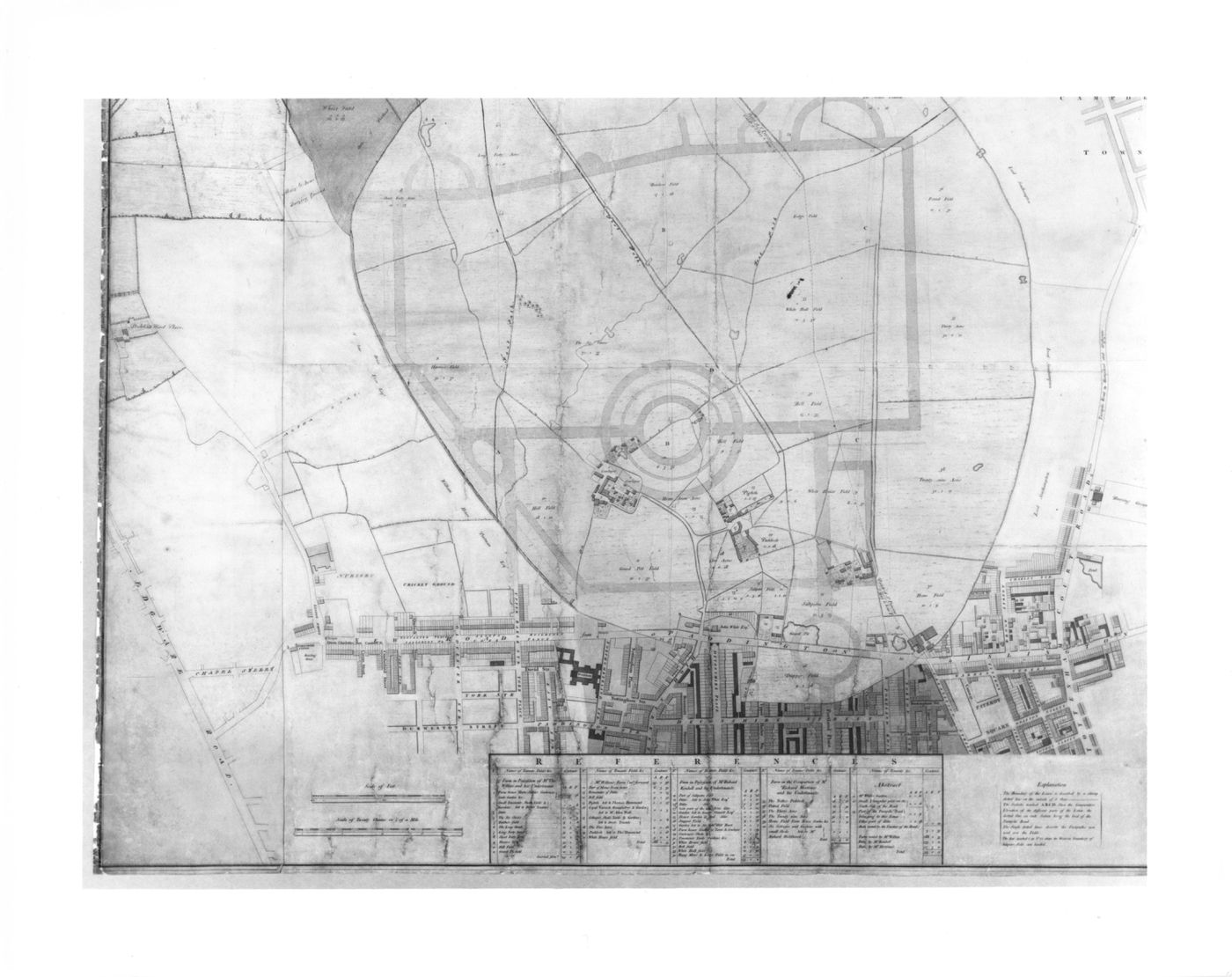
A preliminary design for Regent's Park drawn over a map of the existing site
1811-1812 over a print of ca. 1805
- An engraved map of Marylebone Park and the streets bordering it to the south, with the outline of the street system for an early version of Nash's plan for Regent's Park superimposed in pen and coloured wash.
Pen and black ink with watercolour washes over graphite and engraving
sheet: 134.4 x 113.1 cm
DR1984:0569
Comprised of six sheets joined together and backed with linen. The map image at the top is completely hand drawn; otherwise, hand additions to the engraving indicate proposed transformations or alterations.
imprinted - labels throughout and with a table of property owners keyed to the map, l.c. inscribed - by the draughtsman, in pen and black ink: labels on the hand additions to the engraving
Inscrivez-vous pour recevoir de nos nouvelles
Merci. Vous êtes maintenant abonné. Vous recevrez bientôt nos courriels.
Pour le moment, notre système n’est pas capable de mettre à jour vos préférences. Veuillez réessayer plus tard.
Vous êtes déjà inscrit avec cette adresse électronique. Si vous souhaitez vous inscrire avec une autre adresse, merci de réessayer.
Cete adresse courriel a été définitivement supprimée de notre base de données. Si vous souhaitez vous réabonner avec cette adresse courriel, veuillez contactez-nous
Veuillez, s'il vous plaît, remplir le formulaire ci-dessous pour acheter:
[Title of the book, authors]
ISBN: [ISBN of the book]
Prix [Price of book]
Merci d'avoir passé une commande. Nous vous contacterons sous peu.
Nous ne sommes pas en mesure de traiter votre demande pour le moment. Veuillez réessayer plus tard.
Votre classeur est vide.