

Shifting Shores
Kirsten Keller and Feifei Zhou on the dynamic materialities of property-making in Jakarta
This photo essay is the result of a recent set of site visits along the coast of North Jakarta. The research tour stems from anthropologist Kirsten Keller’s dissertation field research (2017, 2019–2020, 2024) and her prior collaboration with designer and researcher Feifei Zhou in creating the visual essay Flowing Toxins. This time, Zhou and Keller went to Jakarta together to observe how the coast has changed in the past several years. It is not the same landscape; Flowing Toxins is a snapshot in time.
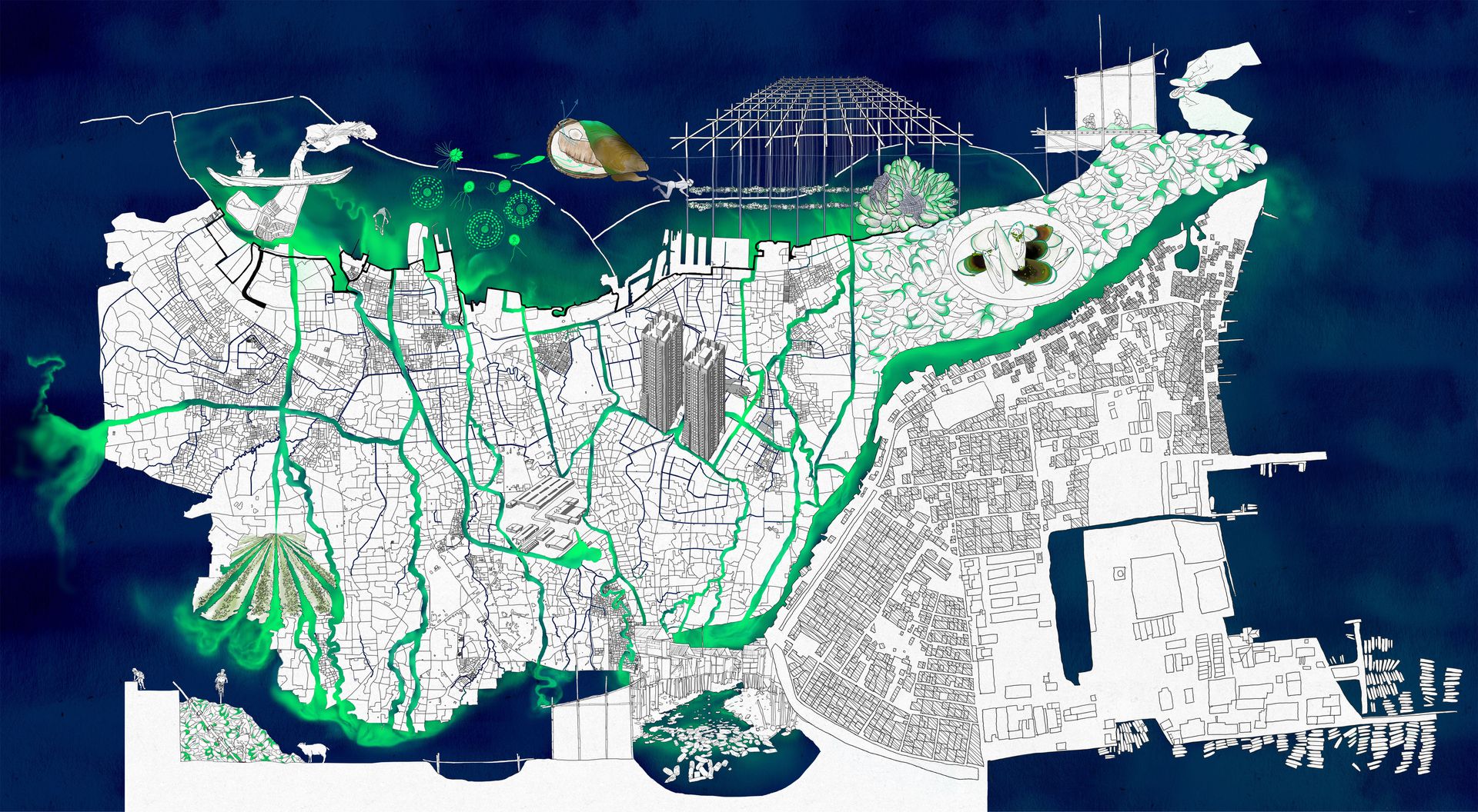
Flowing Toxins, drawing by Feifei Zhou and Kirsten Keller, 2020
Property-making is one of the driving forces of coastal landscape change in Jakarta. As the city runs out of space for new development, property speculation and investment shift to the coast and the Jakarta Bay. This transformation of the built environment generates multiple frictions—between seaside luxury, volatile coastal environmental conditions, and the coastal kampungs (informal urban settlements) that depend on self-organized residence and marine commons. With the photos and commentary below, we reflect upon some of our observations of both the materiality and intentionality of coastal property-making in Jakarta by both profit-driven developers and local communities. We do so by exploring four materials: sand and cement, rubble, sediment, and mussels.
Sand and Cement
Land reclamation projects involve making use of sand and cement to create dry, hard land and property from a watery environment. With the construction of a new capital city for Indonesia—the special capital region of Nusantara in Kalimantan—underway, reclamation has become key to Jakarta’s “waterfront city” approach to urban development. As Nusantara is tasked with building a capital city from scratch, Jakarta, too, is building new urban space from the blank foundation of reclaimed land.
Big land reclamation projects have come in and out of Jakarta’s urban development plans since 1995. Controversial, their integration and permitting are subject to political mood swings. They were formerly included in the National Capital Integrated Coastal Development (NCICD) megaproject, which seeks to redevelop Jakarta’s coast and outfit the city with a giant seawall to protect it against floods. Reclamations were included in the infrastructure blueprints not as physical barriers, but as ways of financing the wall using the revenue from property and commercial development.
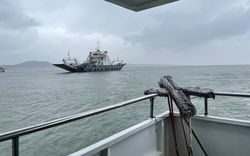
Our site visits began on Pulau D (Island D). The name comes from a previous iteration of the NCICD where seventeen artificial islands were planned to be built in the Bay, each one labelled by a letter.1 Pulau D is also known as “Golf Island,” a name given by property developers, highlighting the large golf course on its north end. The body of the island is composed of mined sand and is secured by concrete and rock revetment, as seen in Figure 1. In the background, the concrete pilings for the construction of an adjacent reclaimed island are visible.
We documented several houses under construction on Pulau D, highlighting a fusion of interpretations of Chinese and European architectural styles expressed through exaggerated postmodern aesthetics (Figure 2). The general urban plan and architectural style of Pulau D is reminiscent of a Tier 2 or 3 Chinese city, particularly with its busy storefronts and restaurants.2 Commercial-residential developments like Pulau D contain establishments that offer a range of Chinese cuisines, products, and cultural resources. The architecture styles are admixtures, but the overall urban layout indicates the significant influence of Chinese-Indonesian developers on coastal reclamation and property in North Jakarta. The reclamation is new (and highly controversial), but Chinese Indonesian communities have also been integral to Jakarta’s cultural and urban development for hundreds of years, with a long history in North Jakarta. Among many other cultural influences, they have created distinct and long-standing architectural styles and spatial layouts in Jakarta.
We also visited Pantai Mutiara, another reclaimed strip of peninsular land located on the east side of Pulau D. Storefronts, buildings, and mansion-like homes on Pantai Mutiara are constructed in a range of ostentatious styles, some with a modern twist. Figure 3 captures a massively scaled private house constructed with colonial architectural features, with the concrete seawall in the foreground dividing not only the land and water, but also public space and a private waterfront yard where yachts can be parked. The island, built up from scratch and swampland, has become a testing ground for an unexpected mixture of architectural styles seemingly devoid of context, as if there exists no tangible spatial, social, or ecological history to reference. A sense of uncanniness exists not only in the juxtapositions between each building, but also in the startling contrasts between Pantai Mutiara and its immediate surroundings.
Figure 4 shows the existing seawall at Pantai Mutiara, another reclamation project that, despite its recent construction, is already sinking. A closer look reveals that the sea level is visibly higher than the constructed ground, separated only by a wall of concrete. Visible marks of reinforcement and added height on the seawall, like a stratigraphic section, are evidence of land subsidence that manifests like sea level rise. However, this wall is simply insufficient for flood protection and currently being replaced, further proving that reclamation projects are not immune to the problems they seek to build away from.
Sand and cement, the fundamental ingredients of our modern built environment, have radically transformed the world’s land and waterscapes through the proliferation of concrete. Believed to be omnipotent material capable of shaping any environment—across climates, forms, and scales—concrete has come to symbolize stability, modernization, and permanence. Yet, the cracks in the seawall reveal more than just the material shortcomings of concrete; they expose the deeper failure of society’s anthropocentric ambitions, which stand in stark contrast to the unpredictable and shifting realities of our Anthropocene future.
-
Of the seventeen proposed artificial islands, only Pulau D and Pulau C are built, while a remnant of Pulau G remains from when its construction was halted during a 2016 moratorium on reclamation in Jakarta Bay. ↩
-
The Chinese city tier system is an unofficial hierarchical classification of Chinese cities depending on their development status. Tier 1 cities include Beijing, Shanghai, Guangzhou, Shenzhen, and the list has recently expanded to include other major cities such as Chengdu and Nanjing as the New Tier 1 cities. ↩
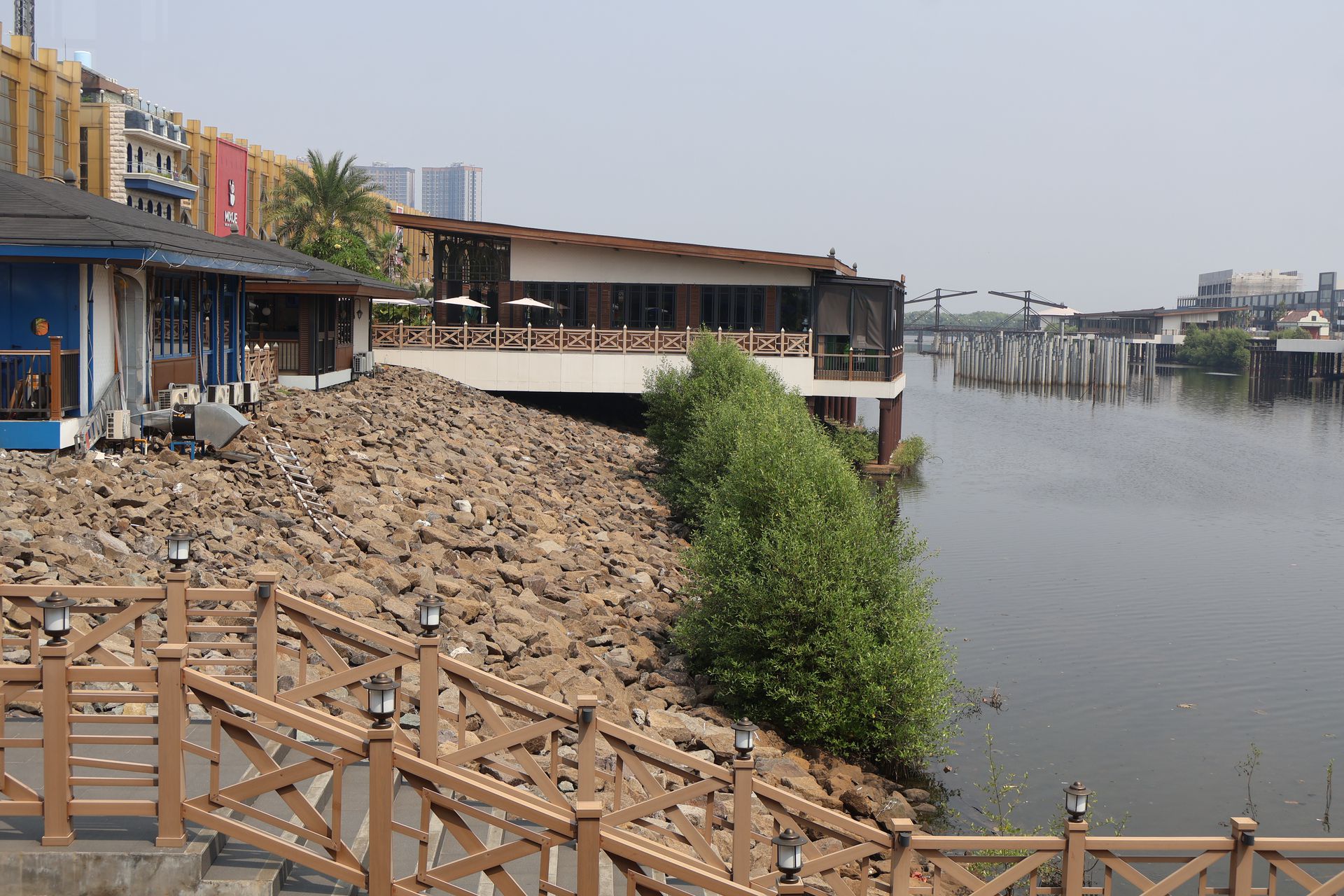
Figure 1
Photograph by Feifei Zhou
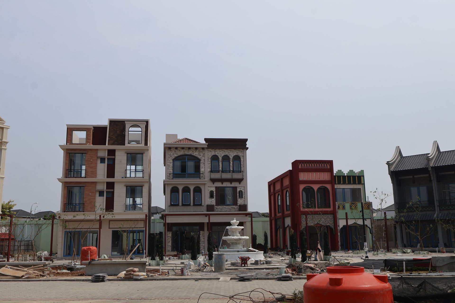
Figure 2
Photograph by Feifei Zhou
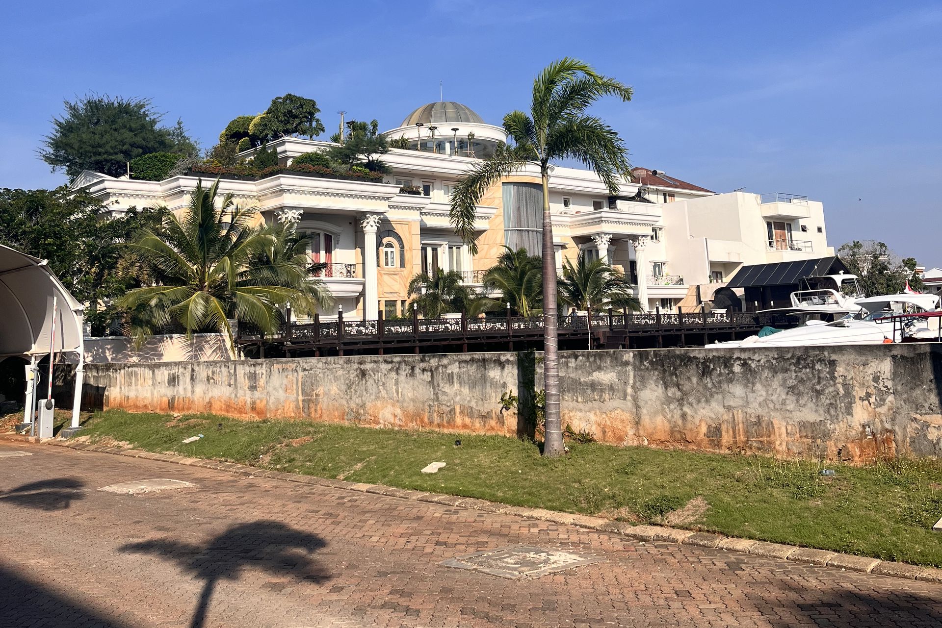
Figure 3
Photograph by Feifei Zhou
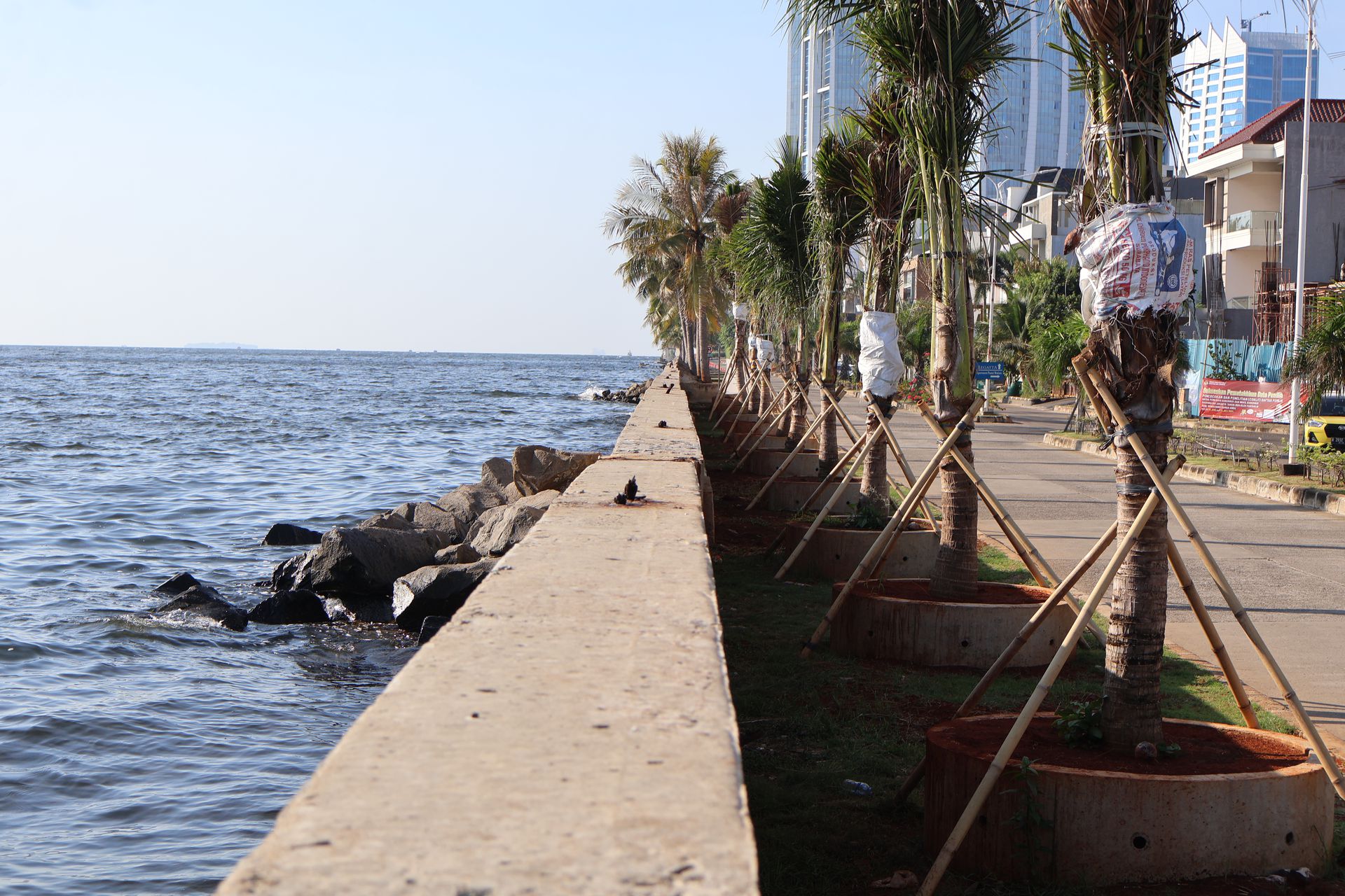
Figure 4
Photograph by Feifei Zhou
Rubble
Concrete’s qualities of being difficult to recycle and generally unsustainable are often underdiscussed in an urban planning context, and the coast of Jakarta reveals what happens in the aftermath of concrete construction. Waste and concrete debris does not simply disappear—it goes to places. In the case of Muara Angke, a kampung on the coast of Jakarta less than three kilometres away from Pulau D and Pantai Mutiara, the waste is transformed into coastal land. Like most coastal areas in Jakarta, sinking and flooding occur frequently there due to rapid land subsidence. The kampung is home to roughly fourteen thousand people, many of whom are fisherfolk without property or land use rights, leaving them vulnerable to eviction and excluded from basic water and sanitation infrastructure. The self-built kampung, as well as the self-reclaimed ground that the kampung sits on, are regarded as illegal settlements in the eyes of the government.
Muara Angke was once a mangrove estuary. Around 1970, migrant fisherfolk from North Java began settling the area through an incremental practice of filling in the swampy, unstable land using various available materials like rubble. Still today, construction waste trucked in from other parts of the city is used to add hard substance to various ground conditions throughout the kampung. We witnessed rubble lining and filling in roads (Figure 5), freshly laid onto pathways (Figure 6), packed around people’s homes for reinforcement and to slow the effects of subsidence, and used as a way to claim land ownership (Figure 7). Seen in Figure 8, the rubble is typically trucked from the city in vast quantities, a waste product of rapid urban development in Jakarta. Expensive to properly dispose of for the developers, the waste is therefore cheaply sold to coastal kampungs as a mutually advantageous solution.
Because of the informal and fragmented manner of constructing land and property, Muara Angke’s experience of subsidence and flooding is also highly unpredictable. The roads erode, sink, and get continuously and unevenly washed out by flood waters, resulting in an aesthetic degradation that renders the kampung a “slum,” a categorically problematic and discriminative term employed in Jakarta’s urban policy language.
As the city of Jakarta continuously builds higher, the escalating load from its rapid expansion pushes the ground beyond its capacity, intensifying the already critical issue of land subsidence. Rubble generated from construction projects, too, is repurposed to raise and reinforce the ground in coastal kampungs like Muara Angke. Jakarta’s territorial expansion extends both horizontally and vertically in spatial terms, but remains driven by conflicting agendas and forms.
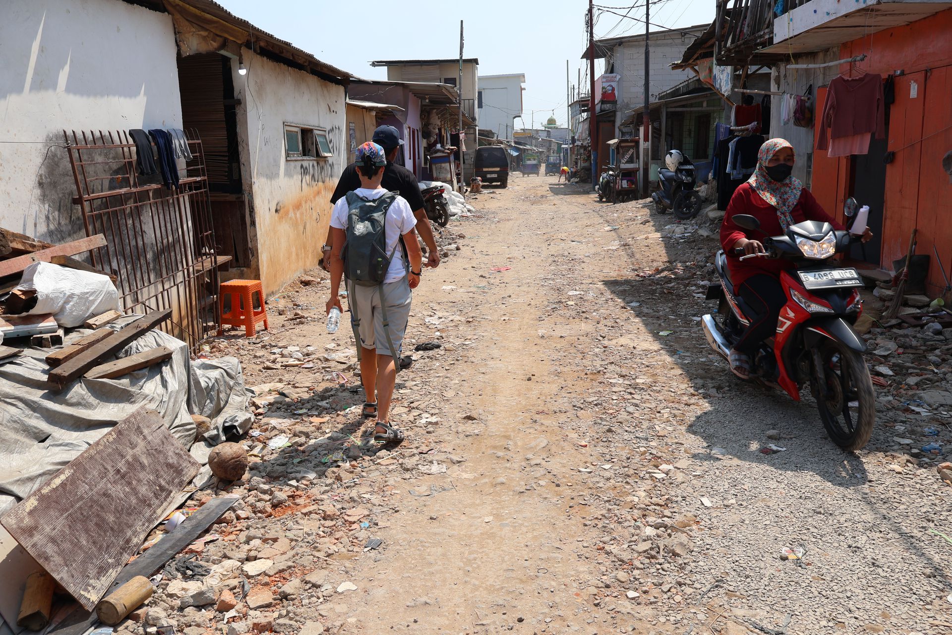
Figure 5
Photograph by Feifei Zhou
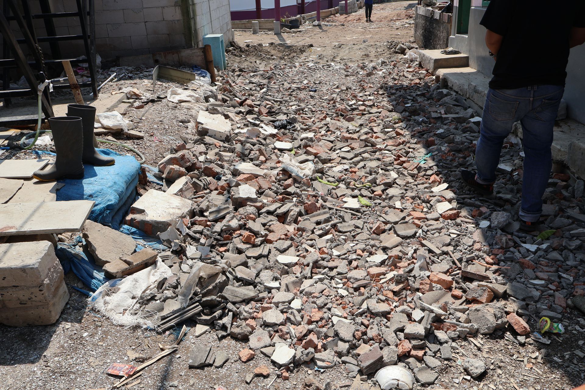
Figure 6
Photograph by Feifei Zhou
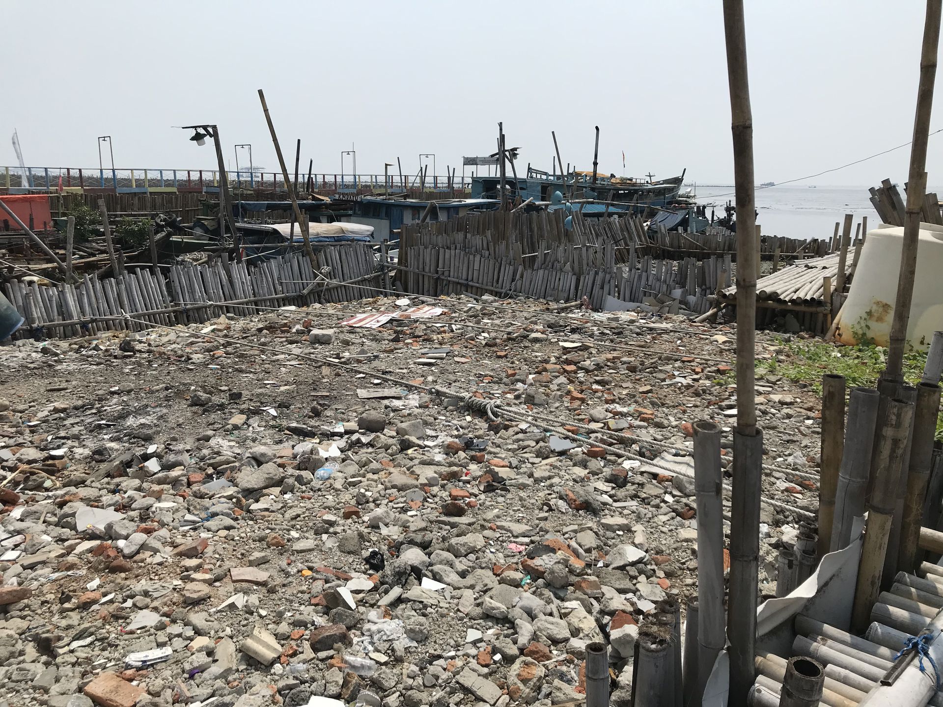
Figure 7
Photograph by Kirsten Keller
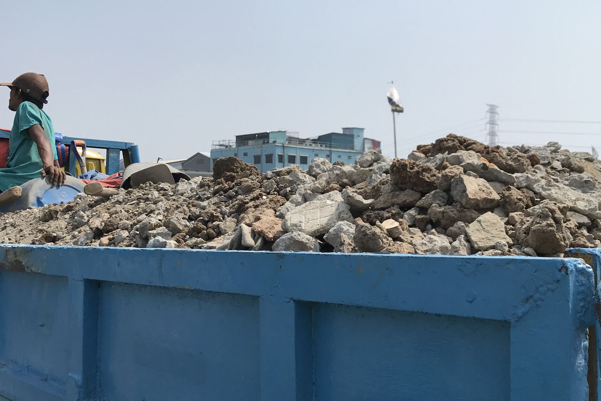
Figure 8
Photograph by Kirsten Keller
Sediment
Muara Angke has seen a radical transformation by sedimentation in the last few years, as a stretch of at least twenty-five metres of new land made up of sediment and garbage has formed along the coast. Stilt houses that were built over the water’s edge are now set back further inland. In Figure 9, what was once sea is now solidified due to sedimentation and solid waste. This sedimentation is a good example of a landscape that is both anthropogenic and subject to the forces independent of human action that we consider “nature.” As an estuary where rivers meet sea, Muara Angke’s coastal front is constantly changing shape due to interaction between currents, tides, and sediment. A time-lapse of satellite images from the early 1990s until now reveals this dynamic sedimentation.
Unplanned accretion of solid ground in Muara Angke is not composed of sediment alone; garbage that continually washes ashore is an essential component. The accumulation of garbage in vast volumes can be sudden and unforeseen. As waste is continually dumped into waterways and upstream erosion and urbanization disrupt normal sedimentation, garbage-laden sedimentation periodically occurs (despite occasional governmental efforts to clear it). This form of sedimentation is also influenced by the loss of coastal “green” infrastructures such as mangroves, seagrasses, and mudflats, which catch sediments that rivers discharge into the ocean. As these amphibious, protective wetland zones are increasingly replaced by seawalls and reclamation, often contaminated sediments that would otherwise be absorbed into the ecosystem are deposited along the coast with fickle effects.
Informal land reclamation is a common practice in coastal kampungs like Muara Angke due to a general paucity of affordable living space. It is unsurprising, then, that people have quickly taken advantage of this sedimentation. In Figure 10, a Muara Angke resident has claimed a plot of land by placing bamboo fences around it. The government, however, considers the new sediment-garbage reclamation state-owned by default. In Figure 11, a resident can be seen adjusting the front of his house to adapt to the new land—note how the stilts anticipate future floods and, perhaps, the disappearance of the sediment-land. However, the sign on the fence states that building upon or using the land is forbidden because it is the property of the provincial government. This juxtaposition highlights the tension between local adaptation and official restrictions.
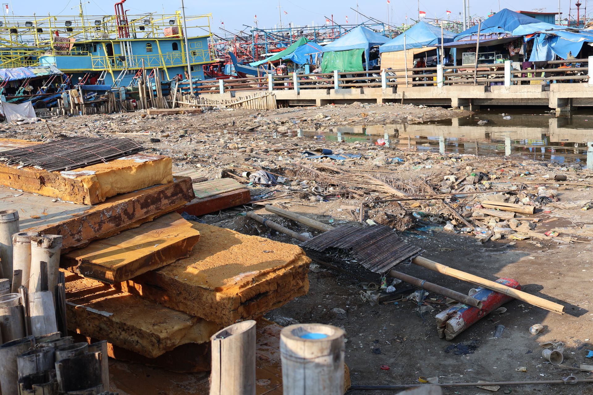
Figure 9
Photograph by Feifei Zhou
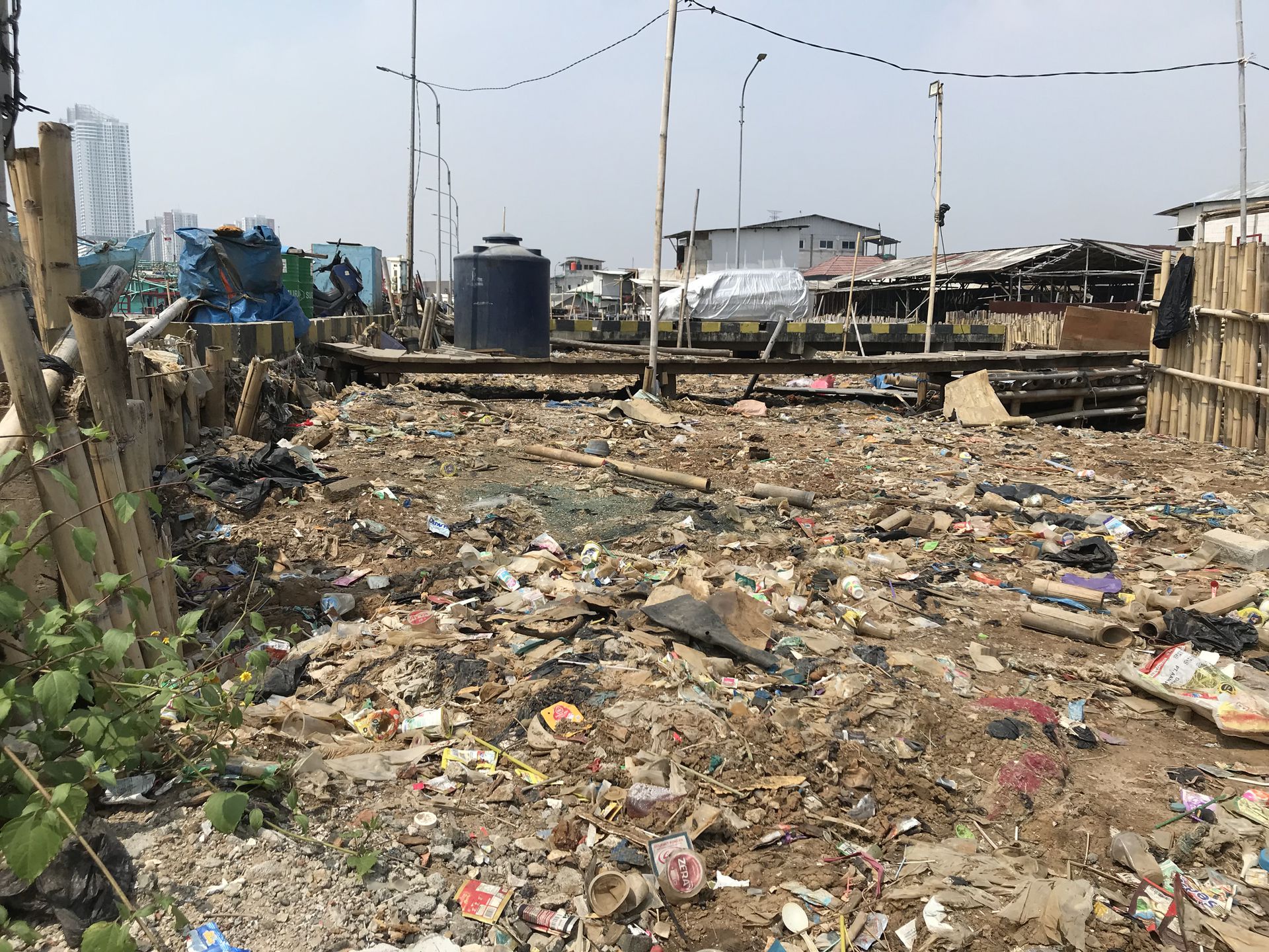
Figure 10
Photograph by Kirsten Keller
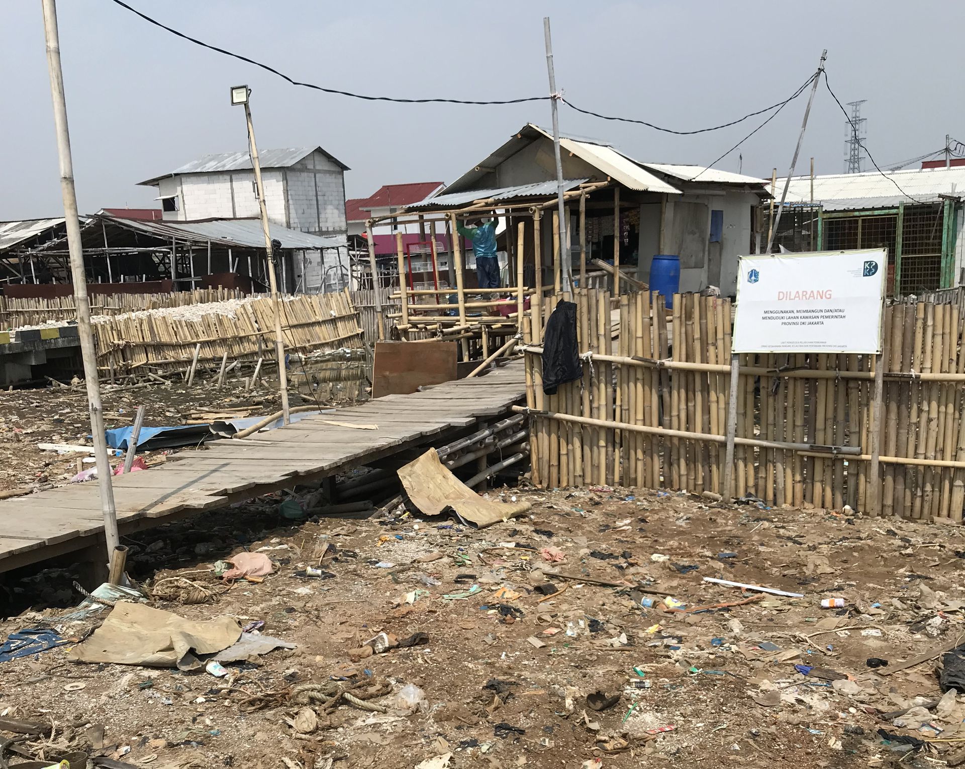
Figure 11
Photograph by Kirsten Keller
Mussels
Another essential reclamation material in Muara Angke is the discarded shell of the Asian green mussel. Mussels are cultivated in the shallow waters of Jakarta Bay by fisherfolk in coastal kampungs, harvested by the tonne, and brought to shore for immediate processing by semi-permanent workers. Larger mussels are sold fresh, while smaller ones are boiled and shucked for their meat (Figure 13), generating huge quantities of shells that people then spread along the waterfront (Figure 14).
Strategic expansion of land along the river and seafront using mussel shells has occurred for at least two decades. The coastline extends outward; meanwhile, the vertical accumulation of the shells helps combat subsidence. This intentionally created land provides more space for fishery work and semi-permanent housing; Figure 12 shows mussel shucking activities upon the shell-reclaimed area. The shells are an unavoidable byproduct of an essential livelihood practice, creatively reused to provide living space for marginalized people. Still, the government considers the practice as encroachment or disorganization, and mussel accumulations are targeted as environmental problems.
Since the appearance of large-scale reclamation projects, Jakarta Bay, mostly regarded by fisherfolk as a commons, is increasingly transformed into terrestrial private property. Being in close proximity to the ocean is desirable for both property developers and fishing communities, although for contrasting reasons. Maintaining a physical connection to the coast is crucial for coastal kampung dwellers to maintain their livelihood practices, which will no longer be viable after being evicted to inland and far-flung places, making way for further private investments into the “waterfront city” ambition of Jakarta Bay.
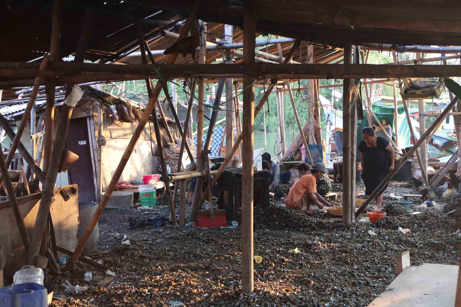
Figure 12
Photograph by Feifei Zhou
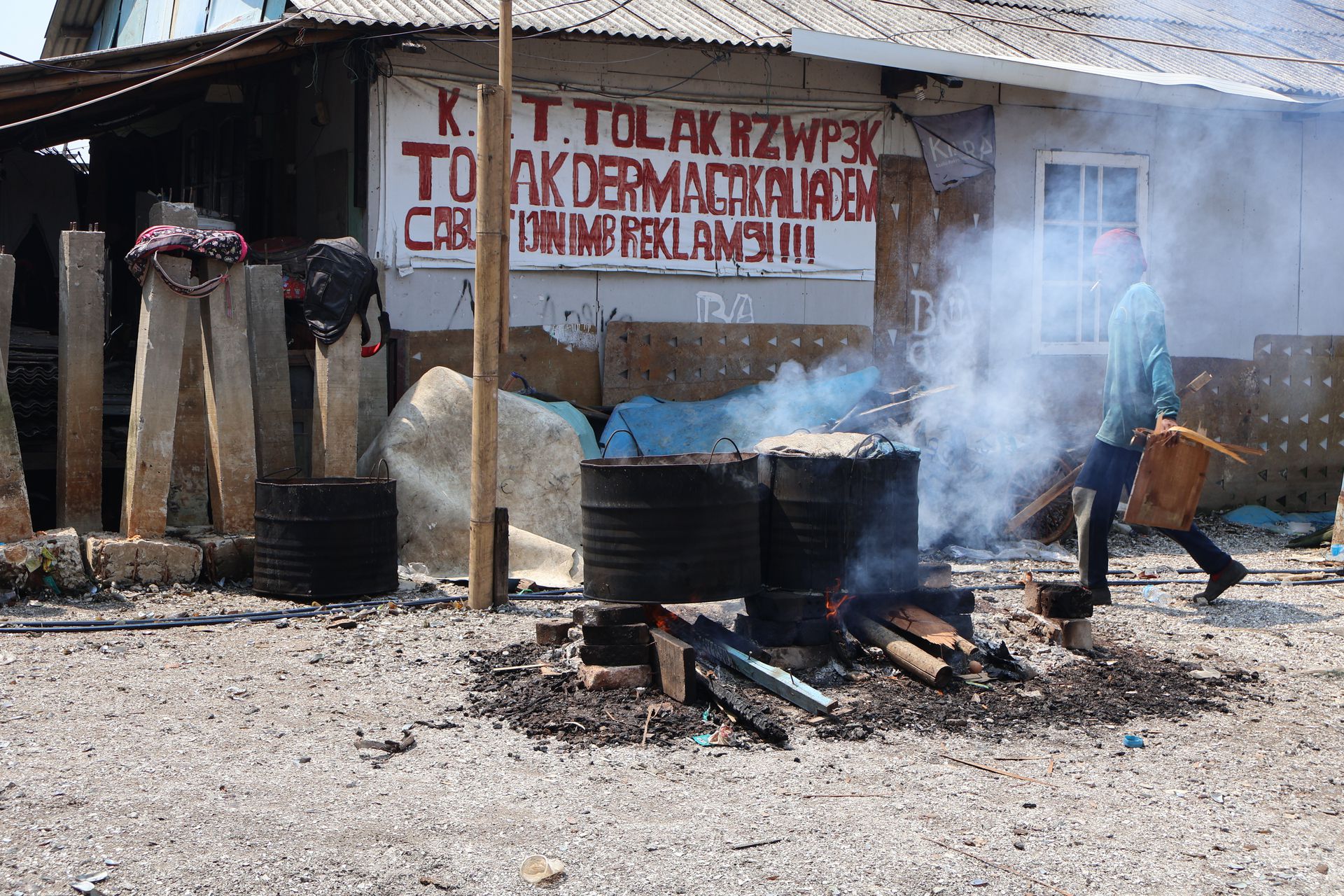
Figure 13
Photograph by Feifei Zhou
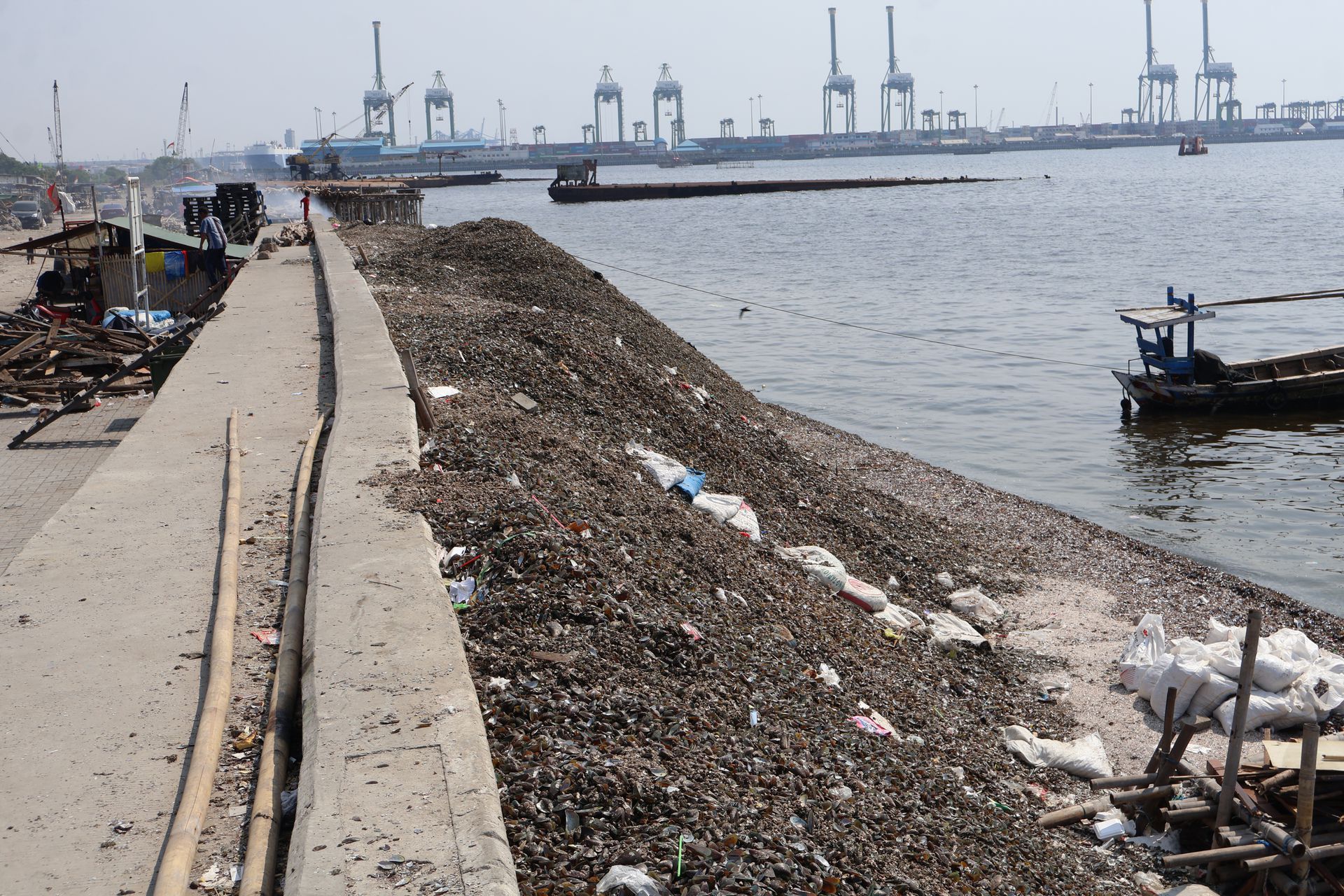
Figure 14
Photograph by Feifei Zhou
These different forces behind property-making result in a complex web of friction that manifests in the scenes we engaged in and sought to depict in our photos. However, the marginalized fishing communities, often unjustly blamed for the waste-filled, polluted environment and stigmatized as unhygienic, are in fact forced to continuously adapt their livelihoods, practices, and architectural styles in response to unpredictable changes in land formations imposed upon them. This adaptation is driven not by choice, but by necessity, as their environment evolves beyond their control.